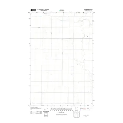
2013 Map of Stephen SW
USGS Topo · Published 2013About this map
Middle River meanders across this rural section of Marshall County, defining the drainage patterns for a landscape dominated by a precise grid of agricultural section lines and county roads. The terrain is characterized by the low relief of the Red River Valley, where irrigation and access are managed via corridors like 420th Ave NW and 320th St NW. Near the southern edge of this 2013 survey, Immanuel Lutheran Cem stands as a local landmark for genealogical research, while the presence of Johnson Airport in the northeast corner serves the regional aviation needs of this farming community. This map offers a clear view of the intersection between historic land divisions and modern infrastructure, tracing the long-standing arterial connections like Pacific Ave and 260th St NW that link isolated farmsteads across the prairie.
Find a feature on this map
13 named features on this map. Tap any name to fly to it.
Don’t see what you’re looking for? This feature index may not catch every label — zoom into the map to look around manually.
Map Details
Editions of this 2013 Stephen SW Map
This is the sole edition of this map. No revisions or reprints were ever made.
Other maps of this area

1918 · Acton
USGS Topo · 1:62,500

1918 · Argyle
USGS Topo · 1:62,500

1918 · Warren
USGS Topo · 1:62,500

1952 · Thief River Falls
USGS Topo · 1:250,000

1954 · Stephen
USGS Topo · 1:62,500

1955 · Warren
USGS Topo · 1:62,500

1956 · Thief River Falls
USGS Topo · 1:250,000

1957 · Thief River Falls
USGS Topo · 1:250,000
1966 · Big Woods NE
USGS Topo · 1:24,000
1966 · Oslo NE
USGS Topo · 1:24,000