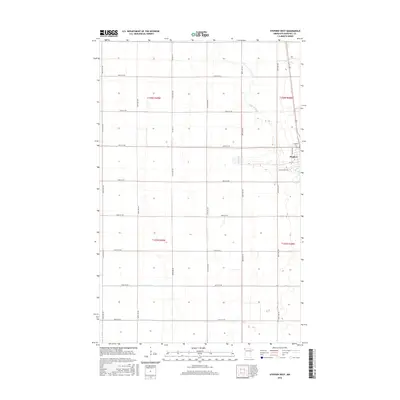
2016 Map of Stephen West
USGS Topo · Published 2016About this map
The town of Stephen sits at the edge of this Marshall County survey, where the town limits meet a landscape defined by industrial-scale agriculture and water management. The Tamarac River meanders through the northern sections, while the southern reaches are dominated by engineered drainage systems like Lateral Number One and Lateral Number Two. These straight-line waterways reflect the intensive land reclamation efforts necessary for Red River Valley farming. Near the town center, local landmarks such as Stephen Cem and the uniquely named Potato Patch Rd provide specific points of interest for genealogists and local historians. The map clearly illustrates the transition from the town's residential street grid, including Lincoln Ave and Fifth St, to the expansive, section-lined farmland that characterizes this region of northwestern Minnesota.
Find a feature on this map
27 named features on this map. Tap any name to fly to it.
Don’t see what you’re looking for? This feature index may not catch every label — zoom into the map to look around manually.
Map Details
Editions of this 2016 Stephen West Map
This is the sole edition of this map. No revisions or reprints were ever made.
Other maps of this area

1918 · Acton
USGS Topo · 1:62,500

1918 · Argyle
USGS Topo · 1:62,500

1939 · Drayton
USGS Topo · 1:62,500

1939 · Kennedy
USGS Topo · 1:62,500

1941 · Kennedy
USGS Topo · 1:62,500

1941 · Drayton
USGS Topo · 1:62,500

1952 · Thief River Falls
USGS Topo · 1:250,000

1954 · Stephen
USGS Topo · 1:62,500

1956 · Thief River Falls
USGS Topo · 1:250,000

1957 · Thief River Falls
USGS Topo · 1:250,000