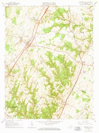
1966 Map of Stephens City
USGS Topo · Published 1967About this map
Stephens City and the surrounding Shenandoah Valley landscape appear here in the mid-1960s, a period marked by the integration of modern infrastructure like Interchange 81 with the region's deep agricultural and industrial roots. The map reveals a complex network of early industry and community life, featuring scattered limestone operations like Quarry and Shale Pit alongside local milling history at Klines Mill and Ridings Mill. Numerous rural congregations and schools, such as Macedonia Ch and Arthel Sch, anchor the smaller crossroads of Armel and Nineveh.
Find a feature on this map
48 named features on this map. Tap any name to fly to it.
Don’t see what you’re looking for? This feature index may not catch every label — zoom into the map to look around manually.
Map Details
Editions of this 1966 Stephens City Map
3 editions found
Other maps of this area

1893 · Luray
USGS Topo · 1:125,000

1894 · Winchester
USGS Topo · 1:125,000

1905 · Luray
USGS Topo · 1:125,000

1923 · Middletown
USGS Topo · 1:62,500

1937 · Middletown
USGS Topo · 1:48,000

1938 · Winchester
USGS Topo · 1:48,000

1939 · Front Royal
USGS Topo · 1:48,000

1942 · Winchester
USGS Topo · 1:62,500

1943 · Middletown
USGS Topo · 1:62,500

1944 · Front Royal
USGS Topo · 1:62,500