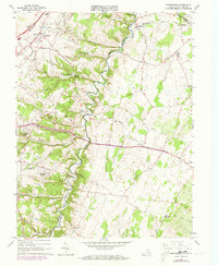
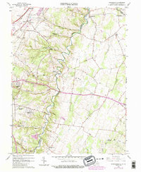
1966 Map of Stephenson
USGS Topo · Published 1973About this map
Opequon Creek winds through the borderlands of Frederick and Clarke counties, anchoring a landscape shaped by early Virginia settlement and the expansion of the Baltimore and Ohio and Penn Central railroads. The topography is defined by established family sites and rural institutions, such as the Emmanuel Ch and Stonewall Sch near Stephenson. The presence of Burnt Factory along the creek and the Holy Trinity Mission Seminary at Jordan Springs illustrates the shift from early industrial milling sites to educational and religious centers. Near the West Virginia border, small communities like Swimley and Wadesville sit among a network of runs, including Turkey Run and Clearbrook Run, where the terrain begins its ascent toward the Backbone. This 1960s perspective, updated in the early 1970s, captures the region's transition as residential pockets like Shenandoah Hills and Greenwood Heights began to expand.
Find a feature on this map
51 named features on this map. Tap any name to fly to it.
Don’t see what you’re looking for? This feature index may not catch every label — zoom into the map to look around manually.
Map Details
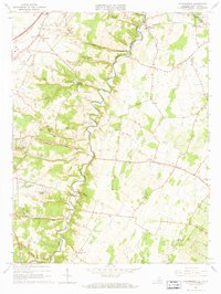
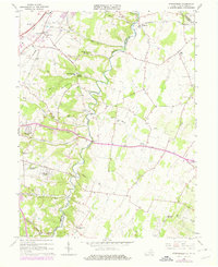
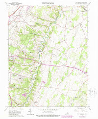
Editions of this 1966 Stephenson Map
5 editions found
Other maps of this area

1884 · Harpers Ferry
USGS Topo · 1:125,000

1891 · Harpers Ferry
USGS Topo · 1:125,000

1893 · Harpers Ferry
USGS Topo · 1:125,000

1894 · Winchester
USGS Topo · 1:125,000

1914 · Martinsburg
USGS Topo · 1:48,000

1914 · Gerrardstown
USGS Topo · 1:48,000

1916 · Gerrardstown
USGS Topo · 1:62,500

1916 · Martinsburg
USGS Topo · 1:62,500

1916 · Berryville
USGS Topo · 1:62,500
1937 · Gerrardstown
USGS Topo · 1:48,000