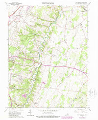
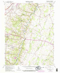
1966 Map of Stephenson
USGS Topo · Published 1987About this map
Opequon Creek meanders deeply through the limestone terrain of the Shenandoah Valley, carving a winding path that defines the border between Frederick and Clarke Counties. This mid-1960s survey captures a landscape of established rural settlements and emerging residential developments like Shenandoah Hills and Greenwood Heights. The area is anchored by the community of Stephenson near the Conrail line, while historic institutional sites like the Holy Trinity Mission Seminary and several country churches point to the region's long-standing social fabric. Transportation routes such as the CSX railroad and Senseny Road follow the natural contours of the land, connecting older points of interest like Burnt Factory and Wadesville. Geologists and historians will note the Shale Pit and various springs, including Horsepen Spring, which highlight the intersection of natural resources and local industry.
Find a feature on this map
50 named features on this map. Tap any name to fly to it.
Don’t see what you’re looking for? This feature index may not catch every label — zoom into the map to look around manually.
Map Details
Editions of this 1966 Stephenson Map
5 editions found
Other maps of this area

1884 · Harpers Ferry
USGS Topo · 1:125,000

1891 · Harpers Ferry
USGS Topo · 1:125,000

1893 · Harpers Ferry
USGS Topo · 1:125,000

1894 · Winchester
USGS Topo · 1:125,000

1914 · Martinsburg
USGS Topo · 1:48,000

1914 · Gerrardstown
USGS Topo · 1:48,000

1916 · Gerrardstown
USGS Topo · 1:62,500

1916 · Martinsburg
USGS Topo · 1:62,500

1916 · Berryville
USGS Topo · 1:62,500

1937 · Gerrardstown
USGS Topo · 1:48,000