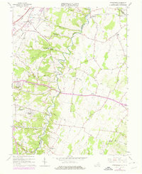
1966 Map of Stephenson
USGS Topo · Published 1978About this map
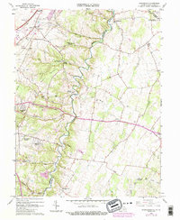
Opequon Creek meanders through this landscape, marking the transition between the agricultural fields and the wooded ridges of the Shenandoah Valley during the late 1960s. The map illustrates a region defined by its religious and educational landmarks, including the Holy Trinity Mission Seminary and numerous country churches like Old Salem Ch and Stones Chapel. Transport networks of the Baltimore and Ohio and Conrail lines intersect near Stephenson, while residential expansion is evident in developments like Shenandoah Hills and Burning Knolls. Local history is deeply embedded in the terrain, from the Devils Backbone ridge to the small industrial traces of a Quarry and Shale Pit. The map captures the area just as modern revisions in the late 1970s added features like the County Fairgrounds and new infrastructure to this evolving borderland between Virginia and West Virginia.
Find a feature on this map
57 named features on this map. Tap any name to fly to it.
Don’t see what you’re looking for? This feature index may not catch every label — zoom into the map to look around manually.
Map Details
Editions of this 1966 Stephenson Map
5 editions found
Other maps of this area

1884 · Harpers Ferry
USGS Topo · 1:125,000

1891 · Harpers Ferry
USGS Topo · 1:125,000

1893 · Harpers Ferry
USGS Topo · 1:125,000

1894 · Winchester
USGS Topo · 1:125,000

1914 · Martinsburg
USGS Topo · 1:48,000

1914 · Gerrardstown
USGS Topo · 1:48,000

1916 · Gerrardstown
USGS Topo · 1:62,500

1916 · Martinsburg
USGS Topo · 1:62,500

1916 · Berryville
USGS Topo · 1:62,500

1937 · Gerrardstown
USGS Topo · 1:48,000