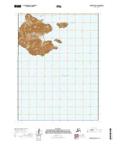
2020 Map of Stepovak Bay D-4 SE
USGS Topo · Published 2020About this map
Chiachi Island dominates this maritime survey, rising sharply from the waters of the Gulf of Alaska. The island’s complex shoreline and steep topography create the sheltered anchorage of Chiachi Bay, a significant natural feature for navigation in this remote archipelago. Surrounding the main island are several smaller landforms, including the distinctively named Pinnacle Rock and Pinusuk Island to the east. This 2020 map, based on data from the U.S. Geological Survey and the Alaska Department of Transportation, provides a high-resolution look at the coastline as it exists in the 21st century. The landscape is characterized by its isolation, with no roads or permanent settlements indicated, focusing entirely on the natural hydrography and terrain of the Chiachi Islands and nearby Petrel Island.
Find a feature on this map
9 named features on this map. Tap any name to fly to it.
Don’t see what you’re looking for? This feature index may not catch every label — zoom into the map to look around manually.
Map Details
Editions of this 2020 Stepovak Bay D-4 SE Map
This is the sole edition of this map. No revisions or reprints were ever made.
Other maps of this area

1951 · Stepovak Bay
USGS Topo · 1:250,000

1963 · Stepovak Bay D-4
USGS Topo · 1:63,360
1963 · Stepovak Bay D-3
USGS Topo · 1:63,360

1963 · Stepovak Bay
USGS Topo · 1:250,000

1969 · Stepovak Bay
USGS Topo · 1:250,000
2020 · Stepovak Bay D-4 NW
USGS Topo · 1:25,000
2020 · Stepovak Bay D-4 NE
USGS Topo · 1:25,000
2020 · Stepovak Bay D-4 OE S NW
USGS Topo · 1:25,000
2020 · Stepovak Bay D-3 NW
USGS Topo · 1:25,000
2020 · Stepovak Bay D-3 SW
USGS Topo · 1:25,000