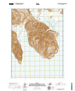
2020 Map of Stepovak Bay D-6 SW
USGS Topo · Published 2020About this map
Clark Bay defines the southern reach of this coastal landscape in the Aleutians East Borough, where the Pacific waters meet a peninsula dominated by high ridges and distinct topographical markers. The coastline is punctuated by Dent Point, a prominent feature that provides a geographical anchor for the eastern shore. Rising sharply from the water, the terrain includes Red Hill and the sheer ascent of the Rock Wall, illustrating the dramatic elevation changes characteristic of this maritime environment. Public Land Survey System boundaries, including t50s r69w and t50s r68w, are clearly delineated, providing essential reference points for land management in this uninhabited region. Sparse but critical landmarks such as Grub Gulch offer additional navigational detail amidst the complex contour patterns of the Alaska Peninsula.
Find a feature on this map
9 named features on this map. Tap any name to fly to it.
Don’t see what you’re looking for? This feature index may not catch every label — zoom into the map to look around manually.
Map Details
Editions of this 2020 Stepovak Bay D-6 SW Map
This is the sole edition of this map. No revisions or reprints were ever made.
Other maps of this area

1951 · Stepovak Bay
USGS Topo · 1:250,000

1953 · Port Moller
USGS Topo · 1:250,000

1963 · Port Moller C-1
USGS Topo · 1:63,360

1963 · Stepovak Bay D-6
USGS Topo · 1:63,360

1963 · Stepovak Bay
USGS Topo · 1:250,000
1963 · Port Moller D-1
USGS Topo · 1:63,360

1969 · Stepovak Bay
USGS Topo · 1:250,000

1988 · Port Moller
USGS Topo · 1:250,000
2020 · Port Moller D-1 NE
USGS Topo · 1:25,000
2020 · Port Moller D-1 SE
USGS Topo · 1:25,000