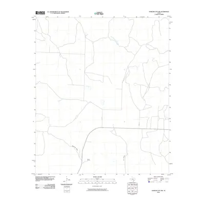
2010 Map of Sterling City NW
USGS Topo · Published 2010About this map
Garrett Windmill stands as a focal point in this portion of Sterling County, marking the practical water-infrastructure necessary for ranching and settlement in the West Texas landscape. The drainage patterns are defined by the winding course of Mackenzie Draw in the south and the seasonal headwaters of North Gasconades Creek to the north. These intermittent watercourses, including Willow Creek, carve low-lying pathways through the terrain toward Cox Hollow. The rural road network is sparse, consisting largely of local routes like Bird Ln and Munn Ln that provide access to the vast ranch lands. This 2010 survey illustrates the enduring nature of the region's land use, where family-named landmarks and essential water-pumping sites continue to define the geography.
Find a feature on this map
7 named features on this map. Tap any name to fly to it.
Don’t see what you’re looking for? This feature index may not catch every label — zoom into the map to look around manually.
Map Details
Editions of this 2010 Sterling City NW Map
This is the sole edition of this map. No revisions or reprints were ever made.
Other maps of this area

1954 · Big Spring
USGS Topo · 1:250,000

1954 · San Angelo
USGS Topo · 1:250,000

1958 · San Angelo
USGS Topo · 1:250,000

1958 · Big Spring
USGS Topo · 1:250,000

1959 · McWhorter Mountain
USGS Topo · 1:24,000

1959 · Dead Indian Mountain
USGS Topo · 1:24,000

1963 · Cumbie Draw
USGS Topo · 1:24,000

1963 · Cumbie Draw NE
USGS Topo · 1:24,000

1963 · Buffalo Draw
USGS Topo · 1:24,000

1965 · San Angelo
USGS Topo · 1:250,000