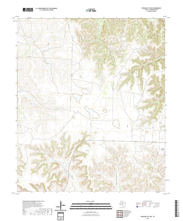
2022 Map of Sterling City NW
USGS Topo · Published 2022About this map
Mackenzie Draw and Cox Hollow define the dissected plateau of this West Texas landscape, where seasonal watercourses like N Gasconades Cr and Willow Cr carve through the high plains. The area is marked by a network of rural routes, including Co Rd 401-P and Bird Ln, which support the ranching and livestock operations characteristic of Sterling County. A notable point of navigation in this open country is Bodine Airport, located in the southeastern quadrant. This modern topographic study illustrates the transition from high, flat-topped mesas to the intricate drainage systems that feed the Concho River watershed, offering a precise look at the land use and property boundaries in a region where geography dictates the pace of movement and settlement.
Find a feature on this map
12 named features on this map. Tap any name to fly to it.
Don’t see what you’re looking for? This feature index may not catch every label — zoom into the map to look around manually.
Map Details
Editions of this 2022 Sterling City NW Map
This is the sole edition of this map. No revisions or reprints were ever made.
Other maps of this area

1954 · Big Spring
USGS Topo · 1:250,000

1954 · San Angelo
USGS Topo · 1:250,000

1958 · San Angelo
USGS Topo · 1:250,000

1958 · Big Spring
USGS Topo · 1:250,000

1959 · McWhorter Mountain
USGS Topo · 1:24,000

1959 · Dead Indian Mountain
USGS Topo · 1:24,000

1963 · Cumbie Draw
USGS Topo · 1:24,000

1963 · Cumbie Draw NE
USGS Topo · 1:24,000

1963 · Buffalo Draw
USGS Topo · 1:24,000

1965 · San Angelo
USGS Topo · 1:250,000