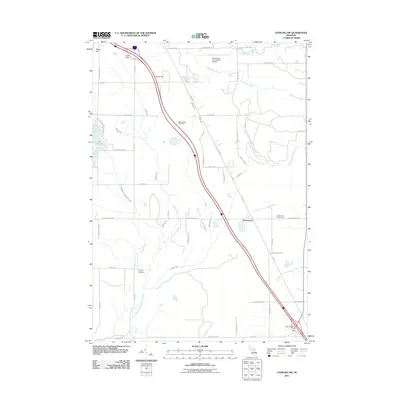
2011 Map of Sterling NW
USGS Topo · Published 2011About this map
Bourret Cemetery and the settlement of Greenwood anchor the southern portion of this Michigan landscape in Ogemaw County. The terrain is defined by glacial elevations such as Tolfee Hill, Cook Hills, and Kuhn Hill, which rise above the headwaters of several critical drainages. This area marks a significant hydrological divide where the West Branch Rifle River flows toward the northeast while the East Branch Tittabawassee River and its tributaries, including Spring Creek and LaPorte Creek, lead south. Transport and infrastructure are prominent, with the West Branch Community Airport serving the region and a major north-south corridor cutting through the center of the sheet, supported by the West Branch Rest Area and Alger Rest Area. Local recreation centers on the western edge near Lake George and the eastern Greenwood Campground, illustrating a mix of seasonal tourism and established rural homesteads.
Find a feature on this map
43 named features on this map. Tap any name to fly to it.
Don’t see what you’re looking for? This feature index may not catch every label — zoom into the map to look around manually.
Map Details
Editions of this 2011 Sterling NW Map
This is the sole edition of this map. No revisions or reprints were ever made.
Other maps of this area

1954 · Traverse City
USGS Topo · 1:250,000

1958 · Traverse City
USGS Topo · 1:250,000

1965 · West Branch
USGS Topo · 1:24,000

1965 · Ogemaw Springs
USGS Topo · 1:24,000

1965 · Selkirk
USGS Topo · 1:24,000

1968 · Sterling
USGS Topo · 1:24,000
1968 · Skidway Lake
USGS Topo · 1:24,000

1968 · Sterling SW
USGS Topo · 1:24,000

1968 · Sterling NW
USGS Topo · 1:24,000

1969 · Edwards
USGS Topo · 1:24,000