
1968 Map of Sterling NW
USGS Topo · Published 1971About this map
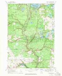
The Ogemaw State Forest and Tittabawassee River State Forest dominate this Northern Michigan landscape, where the borders of Ogemaw, Gladwin, and Arenac counties converge. The terrain is defined by the high elevations of Kuhn Hill and the Cook Hills, punctuated by numerous gravel pits that speak to the region's extractive industry. Water is a central feature, with the Tittabawassee River flowing through the south and the West Branch Rifle River cutting across the northeast corner near Roadside Park.
Find a feature on this map
36 named features on this map. Tap any name to fly to it.
Don’t see what you’re looking for? This feature index may not catch every label — zoom into the map to look around manually.
Map Details
Editions of this 1968 Sterling NW Map
This is the sole edition of this map. No revisions or reprints were ever made.
Other maps of this area

1954 · Traverse City
USGS Topo · 1:250,000

1958 · Traverse City
USGS Topo · 1:250,000

1965 · West Branch
USGS Topo · 1:24,000

1965 · Ogemaw Springs
USGS Topo · 1:24,000

1965 · Selkirk
USGS Topo · 1:24,000

1968 · Sterling
USGS Topo · 1:24,000
1968 · Skidway Lake
USGS Topo · 1:24,000

1968 · Sterling SW
USGS Topo · 1:24,000

1969 · Edwards
USGS Topo · 1:24,000
1969 · Secord Lake
USGS Topo · 1:24,000
Featured Places
- West Branch Township, MI
- Mills Township, MI
- Ogemaw Township, MI
- Churchill Township, MI
- Horton Township, MI