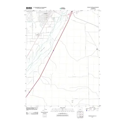
2010 Map of Sterling South
USGS Topo · Published 2010About this map
The agricultural and industrial character of Logan County is defined by the South Platte River and its intricate network of irrigation channels. In this 2010 survey, the southern expansion of Sterling is visible, alongside industrial sites like the Northeastern Pit and Van Gundy Pit. The landscape is a testament to water management in the high plains, featuring a complex system of ditches such as the Springdale Ditch, Lowline Ditch, and Batten Ditch that feed the surrounding acreage. To the south, the terrain opens into Jones Flat and the prominent Hadfield Island, while Riverside Cemetery serves as a significant landmark for those tracing local family histories. Other notable points of interest include Schumans Lake and the small settlement area of Twin Mills near the eastern boundary, illustrating the area's continued reliance on the river and rail-adjacent roads like Old Akron Rd and Old Pole Rd.
Find a feature on this map
36 named features on this map. Tap any name to fly to it.
Don’t see what you’re looking for? This feature index may not catch every label — zoom into the map to look around manually.
Map Details
Editions of this 2010 Sterling South Map
This is the sole edition of this map. No revisions or reprints were ever made.
Other maps of this area

1951 · Reiradon Hill
USGS Topo · 1:24,000

1951 · Sterling South
USGS Topo · 1:24,000

1951 · Sterling North
USGS Topo · 1:24,000

1951 · Galien
USGS Topo · 1:24,000

1951 · Atwood NE
USGS Topo · 1:24,000

1951 · Merino
USGS Topo · 1:24,000

1951 · Atwood
USGS Topo · 1:24,000

1954 · Sterling
USGS Topo · 1:250,000

1958 · Sterling
USGS Topo · 1:250,000

1971 · Merino
USGS Topo · 1:24,000