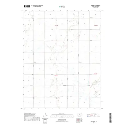
2018 Map of Sterling SW
USGS Topo · Published 2018About this map
The winding course of Salt Cr and Dry Cr defines the landscape of western Reno County, Kansas, in this 2018 survey. The area is characterized by a precise grid of rural thoroughfares, including Peace Rd and Bone Springs Rd, which separate large tracts of agricultural land. The map provides significant detail for genealogists and local historians, pinpointing several established burial grounds such as Salem Cem, Peace Cem, and Fairview Methodist Cem. These sites, often positioned at key road junctions, serve as the primary landmarks for the sparse residential clusters in the region. The drainage patterns of Sugar Cr in the southeast corner illustrate the subtle topography of the prairie, while the township and range boundaries of t23s r8w and t22s r7w anchor the legal divisions of the territory.
Find a feature on this map
26 named features on this map. Tap any name to fly to it.
Don’t see what you’re looking for? This feature index may not catch every label — zoom into the map to look around manually.
Map Details
Editions of this 2018 Sterling SW Map
This is the sole edition of this map. No revisions or reprints were ever made.
Other maps of this area

1892 · Kingman
USGS Topo · 1:125,000

1894 · Kingman
USGS Topo · 1:125,000

1894 · Lyons
USGS Topo · 1:125,000

1955 · Great Bend
USGS Topo · 1:250,000

1955 · Pratt
USGS Topo · 1:250,000

1957 · Great Bend
USGS Topo · 1:250,000

1958 · Great Bend
USGS Topo · 1:250,000

1959 · Pratt
USGS Topo · 1:250,000

1960 · Yaggy
USGS Topo · 1:24,000

1966 · Sterling SW
USGS Topo · 1:24,000