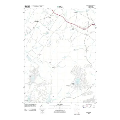
2010 Map of Sterling
USGS Topo · Published 2010About this map
Sterling and its surrounding hamlets in Wayne County are defined by a complex network of glacial ponds and small dams that feed the headwaters of several major regional drainage systems. The landscape transitions from the northern reach of Roaring Brook near Madisonville to the southeastern highlands of Pocono Springs, where residential developments are carved into the woodland around Pocono Peak Lake. Small airfields like Air Haven Airport and Spring Hill Airpark indicate the area's modern character as a recreational and residential retreat. Genealogists and local historians can trace legacy sites such as Freytown Cemetery and Jericho Cemetery, which remain as fixed points amidst the changing rural landscape. The southern portion of the sheet highlights the emergence of the Lehigh River and the West Fork Lehigh River, showing the importance of water management through numerous structures like Larsen Dam and Crystal Lake Dam.
Find a feature on this map
72 named features on this map. Tap any name to fly to it.
Don’t see what you’re looking for? This feature index may not catch every label — zoom into the map to look around manually.
Map Details
Editions of this 2010 Sterling Map
This is the sole edition of this map. No revisions or reprints were ever made.
Other maps of this area

1889 · Scranton
USGS Topo · 1:62,500

1891 · Scranton
USGS Topo · 1:62,500

1893 · Scranton
USGS Topo · 1:62,500

1919 · Pocono
USGS Topo · 1:62,500

1921 · Pocono
USGS Topo · 1:62,500

1922 · Stoddartsville
USGS Topo · 1:62,500

1923 · Pocono
USGS Topo · 1:62,500

1924 · Stoddartsville
USGS Topo · 1:62,500

1928 · Ariel
USGS Topo · 1:62,500

1932 · Ariel
USGS Topo · 1:62,500
Featured Places
- Sterling Township, PA
- Clifton Township, PA
- Dreher Township, PA
- Pocono Springs, PA
- Madisonville, Madison Township