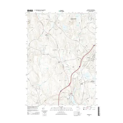
2015 Map of Sterling
USGS Topo · Published 2015About this map
The Stillwater River drainage basin forms the heart of this landscape, flowing south through West Sterling and Moores Corners toward the Thomas Basin. The area is characterized by a high density of water management features, including the Fall Brook Reservoir, Heywood Reservoir, and the Upper Lynde Basin Reservoir, which reflect the region's importance to the metropolitan water supply. Genealogy researchers will find several well-documented burial grounds such as Chocksett Cem and Oak Hill Cem near the town center of Sterling. The terrain is punctuated by significant elevations like Justice Hill and Fitch Hill, while the rail corridor passing through Sterling Junction and Oakdale indicates the historical transportation network that once fueled local industry and connectivity within Worcester County.
Find a feature on this map
135 named features on this map. Tap any name to fly to it.
Don’t see what you’re looking for? This feature index may not catch every label — zoom into the map to look around manually.
Map Details
Editions of this 2015 Sterling Map
This is the sole edition of this map. No revisions or reprints were ever made.
Other maps of this area

1885 · Worcester
USGS Topo · 1:62,500

1886 · Worcester
USGS Topo · 1:62,500

1887 · Marlboro
USGS Topo · 1:62,500

1887 · Fitchburg
USGS Topo · 1:62,500

1889 · Marlboro
USGS Topo · 1:62,500

1889 · Fitchburg
USGS Topo · 1:62,500

1892 · Worcester
USGS Topo · 1:62,500

1893 · Fitchburg
USGS Topo · 1:62,500

1893 · Groton
USGS Topo · 1:62,500

1896 · Marlboro
USGS Topo · 1:62,500