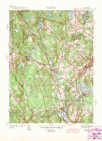
1942 Map of Sterling
USGS Topo · Published 1942About this map
The Stillwater River and Quinapoxet River converge in the south, feeding the Stillwater Basin and Thomas Basin during a period of significant water infrastructure development. A notable engineering feature is Shaft 1 along the Quagbin Aqueduct, part of the massive regional effort to secure water supplies for the Boston area. The village of Oakdale sits near the base of these reservoirs, while the Boston and Maine Railroad creates a transportation corridor through Sterling Junction.
Find a feature on this map
63 named features on this map. Tap any name to fly to it.
Don’t see what you’re looking for? This feature index may not catch every label — zoom into the map to look around manually.
Map Details
Editions of this 1942 Sterling Map
This is the sole edition of this map. No revisions or reprints were ever made.
Other maps of this area

1885 · Worcester
USGS Topo · 1:62,500

1886 · Worcester
USGS Topo · 1:62,500

1887 · Marlboro
USGS Topo · 1:62,500

1887 · Fitchburg
USGS Topo · 1:62,500

1889 · Marlboro
USGS Topo · 1:62,500

1889 · Fitchburg
USGS Topo · 1:62,500

1892 · Worcester
USGS Topo · 1:62,500

1893 · Fitchburg
USGS Topo · 1:62,500

1893 · Groton
USGS Topo · 1:62,500

1896 · Marlboro
USGS Topo · 1:62,500