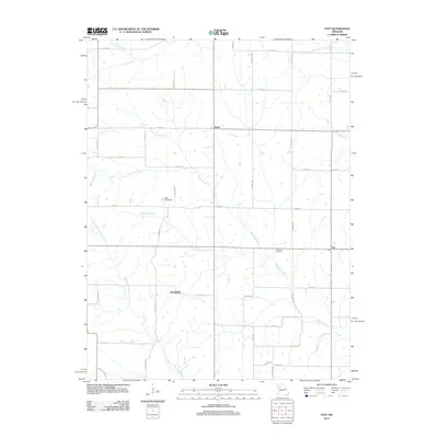
2012 Map of Stet
USGS Topo · Published 2012About this map
Wakenda Creek and its many tributaries, including Crabapple Creek and the West Fork Wakenda Creek, dominate this rural Missouri landscape. This area of Ray County is characterized by small, dispersed settlements such as Stet, Russellville, and Regal, which are connected by a grid of local routes like Cardinal Rd and Oster Rd. The topography is defined by the drainage patterns of these winding waterways, with Cottonwood Creek and Mud Creek carving through the northern sections. Genealogists may find interest in the Penniston Cemetery, located just south of the community of Stet. The land use appears primarily agricultural, punctuated by small landmarks like Klatt Lake Dam, reflecting the region's long-standing reliance on its natural water network.
Find a feature on this map
42 named features on this map. Tap any name to fly to it.
Don’t see what you’re looking for? This feature index may not catch every label — zoom into the map to look around manually.
Map Details
Editions of this 2012 Stet Map
This is the sole edition of this map. No revisions or reprints were ever made.
Other maps of this area

1889 · Lexington
USGS Topo · 1:125,000

1924 · Dawn
USGS Topo · 1:62,500

1924 · Braymer
USGS Topo · 1:62,500

1950 · Plymouth
USGS Topo · 1:24,000

1951 · Utica
USGS Topo · 1:62,500

1953 · Moberly
USGS Topo · 1:250,000

1954 · Moberly
USGS Topo · 1:250,000

1957 · Moberly
USGS Topo · 1:250,000
1957 · Roads
USGS Topo · 1:24,000
1957 · Stet
USGS Topo · 1:24,000