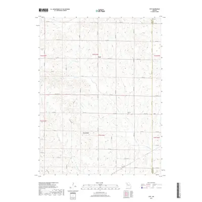
2017 Map of Stet
USGS Topo · Published 2017About this map
Wakenda Creek and its many tributaries, including Crabapple Creek and Cottonwood Creek, carve through the rolling agricultural lands along the border of Ray and Carroll Counties. This 2017 survey shows the dispersed rural settlements of Russellville, Regal, and Stet, which anchor the surrounding farm network. The landscape is defined by a dense grid of secondary roads such as State Highway A and Cardinal Road that follow the section lines and ridgelines above the creek bottoms. Genealogists and local historians will find the Penniston Cemetery located just north of State Highway K. The map also traces the northern reaches of the drainage system toward Mud Creek and South Mud Creek, illustrating how the local geography dictates the layout of modern farmsteads and transport routes in this Missouri river-basin region.
Find a feature on this map
58 named features on this map. Tap any name to fly to it.
Don’t see what you’re looking for? This feature index may not catch every label — zoom into the map to look around manually.
Map Details
Editions of this 2017 Stet Map
This is the sole edition of this map. No revisions or reprints were ever made.
Other maps of this area

1889 · Lexington
USGS Topo · 1:125,000

1924 · Dawn
USGS Topo · 1:62,500

1924 · Braymer
USGS Topo · 1:62,500

1950 · Plymouth
USGS Topo · 1:24,000

1951 · Utica
USGS Topo · 1:62,500

1953 · Moberly
USGS Topo · 1:250,000

1954 · Moberly
USGS Topo · 1:250,000

1957 · Moberly
USGS Topo · 1:250,000
1957 · Roads
USGS Topo · 1:24,000
1957 · Stet
USGS Topo · 1:24,000