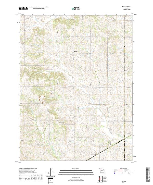
2021 Map of Stet
USGS Topo · Published 2021About this map
The borderlands of Ray and Carroll counties are defined here by a network of dendritic waterways cutting through the Missouri landscape. Stet sits at the intersection of State Hwy K and State Hwy JJ, serving as a focal point for the surrounding agricultural community. Further west, the small settlements of Regal and Russellville are linked by a grid of rural routes like State Hwy A and State Hwy W. The topography is shaped by the significant drainage of Wakenda Cr and its various tributaries, including Crabapple Cr and W Fork Wakenda Cr. For those researching local lineages, the Penniston Cem is located north of Stet, a quiet landmark amidst the fields. This modern survey provides a detailed view of these rural communities and the family-named roads that connect them across the county line.
Find a feature on this map
52 named features on this map. Tap any name to fly to it.
Don’t see what you’re looking for? This feature index may not catch every label — zoom into the map to look around manually.
Map Details
Editions of this 2021 Stet Map
This is the sole edition of this map. No revisions or reprints were ever made.
Other maps of this area

1889 · Lexington
USGS Topo · 1:125,000

1924 · Dawn
USGS Topo · 1:62,500

1924 · Braymer
USGS Topo · 1:62,500

1950 · Plymouth
USGS Topo · 1:24,000

1951 · Utica
USGS Topo · 1:62,500

1953 · Moberly
USGS Topo · 1:250,000

1954 · Moberly
USGS Topo · 1:250,000

1957 · Moberly
USGS Topo · 1:250,000
1957 · Roads
USGS Topo · 1:24,000
1957 · Stet
USGS Topo · 1:24,000