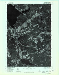
1975 Map of Stetson SW
USGS Topo · Published 1980About this map
Sebasticook Lake dominates the northern landscape of this Maine orthophotoquad, its waters extending into a region defined by agricultural clearing and forest patches. Unlike a standard topographic map, this imagery provides a direct visual record of the land surface in the mid-1970s, showing the precise outlines of woodlots and farm fields. The village of East Newport sits at a critical junction of roads and rail corridors, while to the south, the settlement of Plymouth rests at the head of Plymouth Pond. Between these two hubs, the course of Martin Stream winds through low-lying terrain, flanked by the rise of Billings Hill. This aerial survey captures the rural character of the Penobscot County interior just as interstate development was firmly established across the landscape.
Find a feature on this map
6 named features on this map. Tap any name to fly to it.
Don’t see what you’re looking for? This feature index may not catch every label — zoom into the map to look around manually.
Map Details
Editions of this 1975 Stetson SW Map
This is the sole edition of this map. No revisions or reprints were ever made.
Other maps of this area

1926 · Burnham
USGS Topo · 1:62,500

1930 · Pittsfield
USGS Topo · 1:48,000

1931 · Stetson
USGS Topo · 1:48,000

1932 · Brooks
USGS Topo · 1:62,500

1932 · Pittsfield
USGS Topo · 1:62,500

1933 · Pittsfield
USGS Topo · 1:62,500

1935 · Stetson
USGS Topo · 1:62,500

1948 · Bangor
USGS Topo · 1:250,000

1955 · Pittsfield
USGS Topo · 1:62,500

1955 · Brooks
USGS Topo · 1:62,500