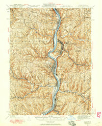
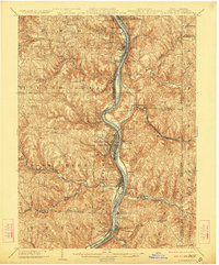
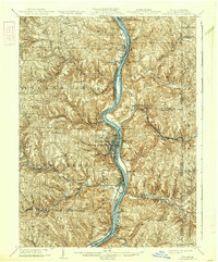
1904 Map of Steubenville
USGS Topo · Published 1915About this map
The Ohio River valley serves as a bustling industrial corridor in the early 20th century, dominated by the major settlement of Steubenville and a dense network of competing rail lines. As steel and coal transport shaped the region, tracks of the Cleveland and Pittsburgh Div. and the W. and L. E. R. R. hugged the riverbanks, connecting river towns like Toronto and Mingo Junction. The landscape is deeply dissected by tributaries such as Cross Creek and Island Creek, where numerous smaller settlements like Knoxville and Jeddo are established in the uplands. Notable river features include Browns Island and active transit points like Middle Ferry and Lower Ferry, illustrating how the waterway remained a primary artery for trade and local movement between Ohio and the West Virginia panhandle at Wellsburg and Hollidays Cove.
Find a feature on this map
94 named features on this map. Tap any name to fly to it.
Don’t see what you’re looking for? This feature index may not catch every label — zoom into the map to look around manually.
Map Details
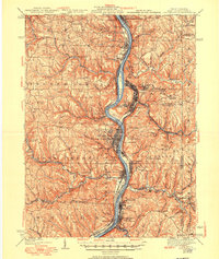
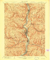
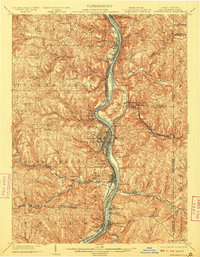
Editions of this 1904 Steubenville Map
5 editions found

Historical Maps of Weirton Through Time
3 maps found