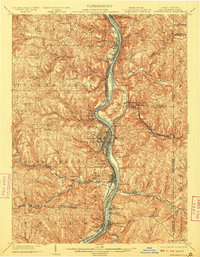
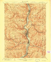
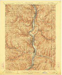
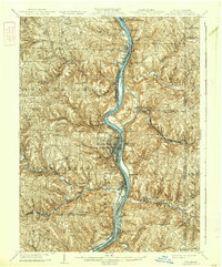
1904 Map of Steubenville
USGS Topo · Published 1909About this map
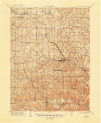
Steubenville serves as the industrial and population hub of this Upper Ohio Valley survey, anchoring a landscape defined by the deep dissection of the Ohio River. At the turn of the century, the river was the primary artery of commerce, mirrored by an intensive network of rail lines including the Cleveland and Pittsburg Division and the P C C and St L RR. The geography reveals a dense pattern of riverside development from Toronto and Jeddo in the north down to Wellsburg and Brilliant in the south.
Find a feature on this map
90 named features on this map. Tap any name to fly to it.
Don’t see what you’re looking for? This feature index may not catch every label — zoom into the map to look around manually.
Map Details
Editions of this 1904 Steubenville Map
5 editions found
Other maps of this area

1901 · Cadiz
USGS Topo · 1:62,500

1901 · Beaver
USGS Topo · 1:62,500

1902 · Wheeling
USGS Topo · 1:62,500

1903 · Cadiz
USGS Topo · 1:62,500

1904 · Wellsville
USGS Topo · 1:62,500

1904 · Steubenville
USGS Topo · 1:62,500

1904 · Beaver
USGS Topo · 1:62,500

1904 · Burgettstown
USGS Topo · 1:62,500

1905 · St. Clairsville
USGS Topo · 1:62,500
1905 · Salineville
USGS Topo · 1:62,500