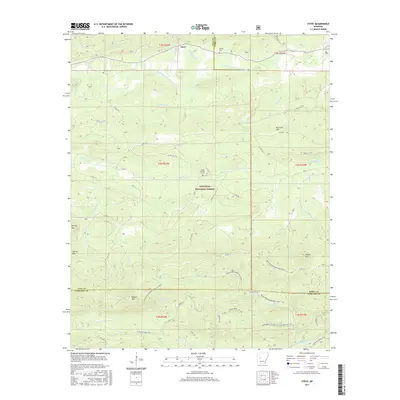
2017 Map of Steve
USGS Topo · Published 2017About this map
The South Fourche LaFave River winds through the northern reaches of this territory, where the small settlement of Steve sits near the crossing of Buchanan Cr. This area of Yell County is defined by a series of prominent peaks and ridgelines, including Worley Mtn, Spring Mtn, and Potato Hill, which overlook a complex network of drainage creeks like Graham Creek and Hutto Br.
Find a feature on this map
62 named features on this map. Tap any name to fly to it.
Don’t see what you’re looking for? This feature index may not catch every label — zoom into the map to look around manually.
Map Details
Editions of this 2017 Steve Map
This is the sole edition of this map. No revisions or reprints were ever made.
Other maps of this area

1890 · Hot Springs
USGS Topo · 1:125,000

1894 · Hot Springs
USGS Topo · 1:125,000

1955 · Little Rock
USGS Topo · 1:250,000

1956 · Little Rock
USGS Topo · 1:250,000

1960 · Little Rock
USGS Topo · 1:250,000

1962 · Avant
USGS Topo · 1:24,000

1962 · Fannie
USGS Topo · 1:24,000

1964 · Little Rock
USGS Topo · 1:250,000
1968 · Plainview
USGS Topo · 1:24,000
1968 · Onyx
USGS Topo · 1:24,000