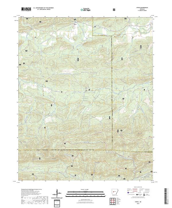
2024 Map of Steve
USGS Topo · Published 2024About this map
Steve sits at the northern edge of this map where the South Fourche LaFave River winds through the hills of Yell County. Much of the southern landscape is protected within the Ouachita National Forest, a terrain of high ridges and deep drainages defined by Dry Fork Mountain, Powell Mtn, and Potato Hill. The map provides a detailed view of the forest's interior infrastructure, showing a network of specialized routes such as the Bear Creek Equestrian Trl and Bucktine Trl. Local genealogy is anchored by small rural burial sites, including Nooner Cem, Shed Cem, and Hames Number 2 Cem, which are scattered among the timbered slopes. This modern survey effectively captures the intersection of recreational trails and the traditional river-and-creek geography that has shaped this part of the Ouachita Mountains for generations.
Find a feature on this map
63 named features on this map. Tap any name to fly to it.
Don’t see what you’re looking for? This feature index may not catch every label — zoom into the map to look around manually.
Map Details
Editions of this 2024 Steve Map
This is the sole edition of this map. No revisions or reprints were ever made.
Other maps of this area

1890 · Hot Springs
USGS Topo · 1:125,000

1894 · Hot Springs
USGS Topo · 1:125,000

1955 · Little Rock
USGS Topo · 1:250,000

1956 · Little Rock
USGS Topo · 1:250,000

1960 · Little Rock
USGS Topo · 1:250,000

1962 · Avant
USGS Topo · 1:24,000

1962 · Fannie
USGS Topo · 1:24,000

1964 · Little Rock
USGS Topo · 1:250,000
1968 · Plainview
USGS Topo · 1:24,000
1968 · Onyx
USGS Topo · 1:24,000