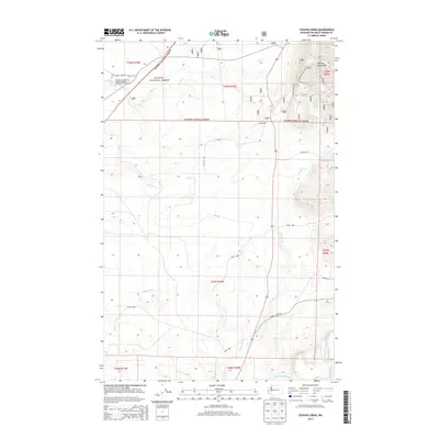
2014 Map of Stevens Creek
USGS Topo · Published 2014About this map
The Olympic National Forest dominates this coastal Washington landscape, where the foothills of the Olympic Mountains meet a dense network of river systems. The northern portion of the map is notable for the US Fish and Wildlife Service Quinault National Fish Hatchery, situated near the headwaters of Cook Creek. This area serves as a critical watershed, with the Copalis River and the Humptulips River drainage systems carving through the timberlands. A complex grid of forest service roads, including Quinault Ridge Road and Donkey Creek Road, provides access through the diverse terrain. The mapping of Stevens Creek and its many tributaries, such as West Fork Stevens Creek, illustrates the intricate drainage patterns essential to the local ecosystem and the regional timber industry during this period.
Find a feature on this map
27 named features on this map. Tap any name to fly to it.
Don’t see what you’re looking for? This feature index may not catch every label — zoom into the map to look around manually.
Map Details
Editions of this 2014 Stevens Creek Map
This is the sole edition of this map. No revisions or reprints were ever made.
Other maps of this area

1921 · Quinault Lake
USGS Topo · 1:62,500

1938 · Moclips
USGS Topo · 1:62,500

1941 · Moclips
USGS Topo · 1:62,500

1943 · Humptulips
USGS Topo · 1:62,500

1943 · Copalis Beach
USGS Topo · 1:250,000

1951 · Copalis Beach
USGS Topo · 1:250,000

1955 · Macafee Hill
USGS Topo · 1:62,500

1955 · Humptulips
USGS Topo · 1:62,500

1955 · Quinault Lake
USGS Topo · 1:62,500

1955 · Carlisle
USGS Topo · 1:24,000