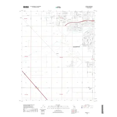
2018 Map of Stevens
USGS Topo · Published 2018About this map
The Kern River meanders through this portion of the San Joaquin Valley, illustrating the complex water management system vital to the region's agricultural and urban development. Residential expansion from Bakersfield is evident in the northeast, with suburban street grids like Chateau Montelena Dr and Michaelangelo Dr pushing into formerly open land. The landscape is defined by its industrial-scale irrigation network, including the Cross Valley Canal, James Canal, and Buena Vista Canal, which follow the natural contours of the valley floor alongside the historic path of Goose Lake Slough. In the center of the sheet, the settlement of Stevens sits at the intersection of rural transit and large-scale farming tracts. This 2018 survey captures a moment where traditional ranching landmarks like Moon Ranch St meet modern arterial roads such as Stockdale Hwy and Panama Ln.
Find a feature on this map
98 named features on this map. Tap any name to fly to it.
Don’t see what you’re looking for? This feature index may not catch every label — zoom into the map to look around manually.
Map Details
Editions of this 2018 Stevens Map
This is the sole edition of this map. No revisions or reprints were ever made.
Other maps of this area

1906 · Bakersfield
USGS Topo · 1:62,500

1910 · Buena Vista Lake
USGS Topo · 1:125,000

1912 · Buena Vista Lake
USGS Topo · 1:125,000

1929 · Stevens
USGS Topo · 1:31,680

1929 · Coles Levee
USGS Topo · 1:31,680

1929 · Mouth of Kern
USGS Topo · 1:31,680

1930 · Millux
USGS Topo · 1:31,680

1930 · Rosedale
USGS Topo · 1:31,680

1930 · Conner
USGS Topo · 1:31,680

1930 · Oildale
USGS Topo · 1:31,680