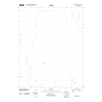
2010 Map of Stevens Mesa
USGS Topo · Published 2010About this map
Stevens Mesa stands as a central topographic feature in this arid Garfield County landscape, defined by a complex network of seasonal drainage and prominent high ground. The terrain is structured by a series of significant landforms, including Thompson Mesa to the west and the expansive Upper Blue Hills to the north. Water management and natural drainage patterns are evident through the paths of Sweetwater Creek, which meanders through the western portion of the quadrangle, and Cedar Creek, which dominates the eastern half before reaching the Cedar Creek Bench. This 2010 survey captures a region where the geography is dictated by the interaction of mesa heights and deep washes, such as Dry Wash and Dugout Wash, illustrating the natural erosion patterns that have shaped this part of Utah. The absence of built settlements highlights the area's role as an undeveloped expanse of public land defined by its geology.
Find a feature on this map
11 named features on this map. Tap any name to fly to it.
Don’t see what you’re looking for? This feature index may not catch every label — zoom into the map to look around manually.
Map Details
Editions of this 2010 Stevens Mesa Map
This is the sole edition of this map. No revisions or reprints were ever made.
Other maps of this area

1885 · San Rafael
USGS Topo · 1:250,000

1885 · Fish Lake
USGS Topo · 1:250,000

1896 · Fish Lake
USGS Topo · 1:250,000

1952 · Notom 4 SE
USGS Topo · 1:24,000

1952 · Notom 4 NE
USGS Topo · 1:24,000

1952 · Notom
USGS Topo · 1:62,500

1954 · Mt. Ellen 2 SE
USGS Topo · 1:24,000

1954 · Mt. Ellen 2 SW
USGS Topo · 1:24,000

1954 · Fruita
USGS Topo · 1:62,500
1954 · Notom 1 SE
USGS Topo · 1:24,000