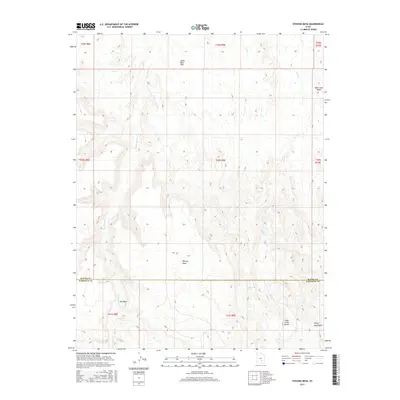
2017 Map of Stevens Mesa
USGS Topo · Published 2017About this map
Stevens Mesa and the northern reaches of the Henry Mountains dominate this high-desert landscape at the border of Wayne and Garfield counties. The terrain is defined by a series of dramatic elevation changes, from the prominent Oak Creek Ridge in the northeast to the expansive Upper Blue Hills in the northwest. Water sources are scarce but critical in this arid environment, marked by isolated points such as Indianwater Seep and Maidenwater Spring.
Find a feature on this map
21 named features on this map. Tap any name to fly to it.
Don’t see what you’re looking for? This feature index may not catch every label — zoom into the map to look around manually.
Map Details
Editions of this 2017 Stevens Mesa Map
This is the sole edition of this map. No revisions or reprints were ever made.
Other maps of this area

1885 · San Rafael
USGS Topo · 1:250,000

1885 · Fish Lake
USGS Topo · 1:250,000

1896 · Fish Lake
USGS Topo · 1:250,000

1952 · Notom 4 SE
USGS Topo · 1:24,000

1952 · Notom 4 NE
USGS Topo · 1:24,000

1952 · Notom
USGS Topo · 1:62,500

1954 · Mt. Ellen 2 SE
USGS Topo · 1:24,000

1954 · Mt. Ellen 2 SW
USGS Topo · 1:24,000

1954 · Fruita
USGS Topo · 1:62,500
1954 · Notom 1 SE
USGS Topo · 1:24,000