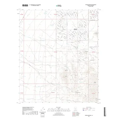
2018 Map of Stevens Mountain
USGS Topo · Published 2018About this map
Diamond Bell Ranch sits as the primary settlement within this desert landscape, characterized by a grid of residential streets that meet the complex drainage patterns of the Sierrita Mountains. The terrain is defined by prominent peaks like Stevens Mtn and Valencia Mtn, which rise above a network of ephemeral watercourses including Fresnal Wash, Soto Wash, and Banner Wash. This 2018 survey reveals the infrastructure of an arid environment where water management is critical, as evidenced by numerous named collection points such as Soldier Well Tank, Calera Tank, and La Cholla Tank. The intricate road names, from W Diamond Bell Ranch Rd to W Powder Horn Dr, illustrate the modern development footprint pressing against the natural contours of Providencia Hill and the surrounding desert foothills.
Find a feature on this map
121 named features on this map. Tap any name to fly to it.
Don’t see what you’re looking for? This feature index may not catch every label — zoom into the map to look around manually.
Map Details
Editions of this 2018 Stevens Mountain Map
This is the sole edition of this map. No revisions or reprints were ever made.
Other maps of this area

1920 · Arivaca
USGS Topo · 1:125,000

1925 · Samaniego Peak
USGS Topo · 1:62,500

1925 · San Xavier
USGS Topo · 1:62,500

1934 · Tucson Mountains
USGS Topo · 1:125,000

1939 · Twin Buttes
USGS Topo · 1:62,500

1940 · Palo Alto Ranch
USGS Topo · 1:62,500

1941 · Twin Buttes
USGS Topo · 1:62,500

1941 · Cocoraque Butte
USGS Topo · 1:62,500

1943 · Cocoraque Butte
USGS Topo · 1:62,500

1943 · Palo Alto Ranch
USGS Topo · 1:62,500