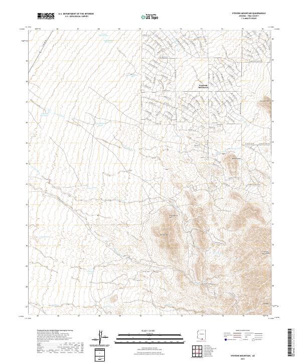
2021 Map of Stevens Mountain
USGS Topo · Published 2021About this map
Diamond Bell Ranch anchor the northern landscape of this Pima County region, where the residential street grid of a rural subdivision meets the expansive topography of the Sonoran desert. The settlement pattern here is characterized by a dense network of planned avenues such as W Killarney Ave and S Renegade Ave that abruptly give way to the natural drainage systems of Soto Wash and Fresnal Wash. This juxtaposition highlights a late-twentieth-century push for desert living on the outskirts of established centers.
Find a feature on this map
120 named features on this map. Tap any name to fly to it.
Don’t see what you’re looking for? This feature index may not catch every label — zoom into the map to look around manually.
Map Details
Editions of this 2021 Stevens Mountain Map
This is the sole edition of this map. No revisions or reprints were ever made.
Other maps of this area

1920 · Arivaca
USGS Topo · 1:125,000

1925 · Samaniego Peak
USGS Topo · 1:62,500

1925 · San Xavier
USGS Topo · 1:62,500

1934 · Tucson Mountains
USGS Topo · 1:125,000

1939 · Twin Buttes
USGS Topo · 1:62,500

1940 · Palo Alto Ranch
USGS Topo · 1:62,500

1941 · Twin Buttes
USGS Topo · 1:62,500

1941 · Cocoraque Butte
USGS Topo · 1:62,500

1943 · Cocoraque Butte
USGS Topo · 1:62,500

1943 · Palo Alto Ranch
USGS Topo · 1:62,500