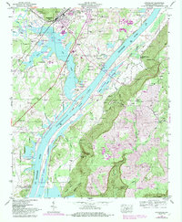
2024 Map of Stevenson
USGS Topo · Published 2024About this map
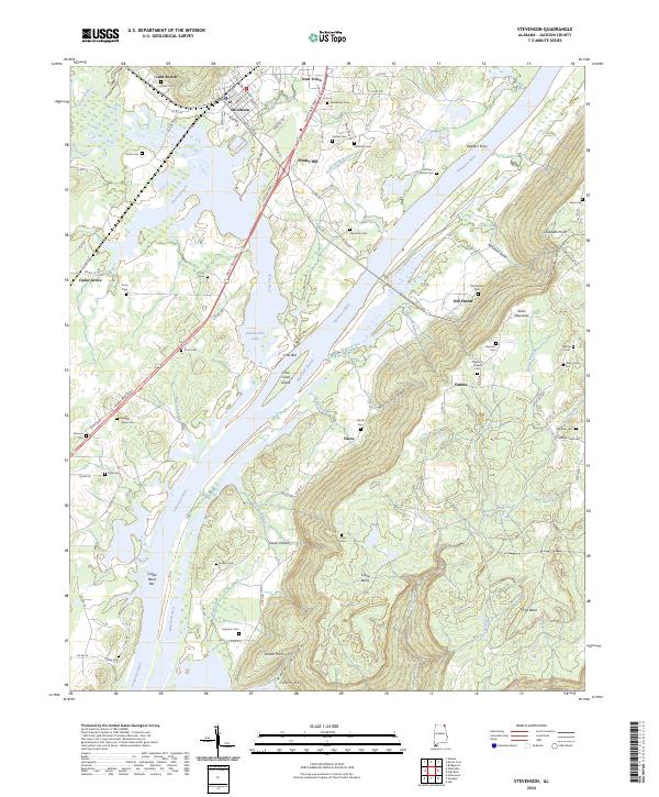
Stevenson sits at a critical junction of geography and transportation where Crow Creek enters the broad reach of the Tennessee River. This modern survey reveals a landscape defined by the expansive waters of Guntersville Lake, which has transformed the river valley into a complex network of inlets and islands, including Crow Creek Island and the shallow Crow Bar. The area maintains deep ties to its 19th-century settlement patterns, evidenced by numerous family burial grounds such as Wimberley Cem, Stogsdill Wynn Cem, and Cawlfield Cem. To the east, the terrain rises sharply into the plateau of Sand Mountain, overlooking the valley floor. Small communities like Fabius and Old Fabius occupy the high ground, while the river's historical importance is noted at Rudders Ferry. The map captures a mix of rural agricultural reaches and the more industrial corridors near New Town, showing how the local topography of hollows and bends, like Wolf Hollow and Craze Bend, continues to shape development in Jackson County.
Find a feature on this map
107 named features on this map. Tap any name to fly to it.
Don’t see what you’re looking for? This feature index may not catch every label — zoom into the map to look around manually.
Map Details
Editions of this 2024 Stevenson Map
This is the sole edition of this map. No revisions or reprints were ever made.
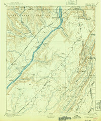
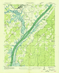
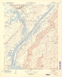
Historical Maps of Fabius Through Time
7 maps found