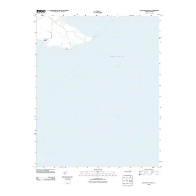
2010 Map of Stevenson Point
USGS Topo · Published 2010About this map
Stevenson Point marks a prominent landform at the confluence of the Little River and the Albemarle Sound in this coastal North Carolina survey. The landscape is dominated by the vast waters of the Atlantic Ocean and the sound, illustrating the maritime character of Perquimans County. On the western bank, the residential development of Carolina Shores is defined by a local road network including Winslow Rd and New Hope Rd. Further south along the shoreline, Reed Point and Webb St indicate localized settlement patterns where the land meets the water. This 2010 edition emphasizes the transition between established coastal communities and the expansive natural waterways of the Albemarle region.
Find a feature on this map
9 named features on this map. Tap any name to fly to it.
Don’t see what you’re looking for? This feature index may not catch every label — zoom into the map to look around manually.
Map Details
Editions of this 2010 Stevenson Point Map
This is the sole edition of this map. No revisions or reprints were ever made.
Other maps of this area

1906 · Hertford
USGS Topo · 1:62,500

1940 · Hertford
USGS Topo · 1:62,500

1940 · Wade Point
USGS Topo · 1:62,500

1943 · Wade Point
USGS Topo · 1:62,500

1943 · Columbia
USGS Topo · 1:125,000

1948 · Wade Point
USGS Topo · 1:62,500

1953 · Norfolk
USGS Topo · 1:250,000

1953 · Columbia East
USGS Topo · 1:24,000

1953 · Columbia West
USGS Topo · 1:24,000
1953 · Fort Landing
USGS Topo · 1:24,000