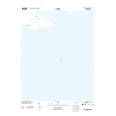
2013 Map of Stevenson Point
USGS Topo · Published 2013About this map
Carolina Shores occupies a small peninsula where the Little River meets the Atlantic Ocean. This coastal landscape is defined by the sharp geography of Stevenson Point and Reed Point, which frame the southern and eastern edges of the settlement. The 2013 survey illustrates a residential layout primarily organized around Sound Side Dr and New Hope Rd, reflecting a community deeply tied to its waterfront positioning. The map primarily consists of open water, highlighting the strategic and vulnerable location of this coastal point. Local access is maintained via secondary routes such as Cross Neck Rd and Winslow Rd, providing insight into the modern road network of this shoreline area.
Find a feature on this map
14 named features on this map. Tap any name to fly to it.
Don’t see what you’re looking for? This feature index may not catch every label — zoom into the map to look around manually.
Map Details
Editions of this 2013 Stevenson Point Map
This is the sole edition of this map. No revisions or reprints were ever made.
Other maps of this area

1906 · Hertford
USGS Topo · 1:62,500

1940 · Hertford
USGS Topo · 1:62,500

1940 · Wade Point
USGS Topo · 1:62,500

1943 · Wade Point
USGS Topo · 1:62,500

1943 · Columbia
USGS Topo · 1:125,000

1948 · Wade Point
USGS Topo · 1:62,500

1953 · Norfolk
USGS Topo · 1:250,000

1953 · Columbia East
USGS Topo · 1:24,000

1953 · Columbia West
USGS Topo · 1:24,000
1953 · Fort Landing
USGS Topo · 1:24,000