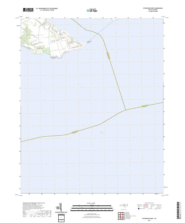
2022 Map of Stevenson Point
USGS Topo · Published 2022About this map
Stevenson Point marks a prominent landform where the Little River meets the expansive waters of the Albemarle Sound. This maritime landscape is defined by the geography of Durants Neck, a peninsula where modern residential development has integrated with the natural shoreline. The street network, including Blue Heron Blvd and Bald Eagle Pointe Dr, reflects a shift toward coastal living and recreation along the sound's edge. At the southern tip, Reed Point serves as a distinct navigational marker. The map also delineates critical water-bound political boundaries, where the jurisdiction of Perquimans Co meets Pasquotank Co and Tyrrell Co in the middle of the sound, illustrating how these historic North Carolina counties are connected by their shared waterways.
Find a feature on this map
21 named features on this map. Tap any name to fly to it.
Don’t see what you’re looking for? This feature index may not catch every label — zoom into the map to look around manually.
Map Details
Editions of this 2022 Stevenson Point Map
This is the sole edition of this map. No revisions or reprints were ever made.
Other maps of this area

1906 · Hertford
USGS Topo · 1:62,500

1940 · Hertford
USGS Topo · 1:62,500

1940 · Wade Point
USGS Topo · 1:62,500

1943 · Wade Point
USGS Topo · 1:62,500

1943 · Columbia
USGS Topo · 1:125,000

1948 · Wade Point
USGS Topo · 1:62,500

1953 · Norfolk
USGS Topo · 1:250,000

1953 · Columbia East
USGS Topo · 1:24,000

1953 · Columbia West
USGS Topo · 1:24,000
1953 · Fort Landing
USGS Topo · 1:24,000