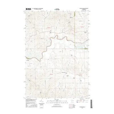
2015 Map of Stevenstown
USGS Topo · Published 2015About this map
Stevenstown sits at the heart of this landscape where the Black River winds along the triple-point junction of Trempealeau, Jackson, and La Crosse Counties. The terrain is defined by a dense network of coulees, including Michelson Coulee, Roberts Coulee, and Stensven Coulee, which channel water into Fleming Creek and the river. This topography dictates the rural road system, which follows the floor of Lewis Valley and several smaller draws.
Find a feature on this map
77 named features on this map. Tap any name to fly to it.
Don’t see what you’re looking for? This feature index may not catch every label — zoom into the map to look around manually.
Map Details
Editions of this 2015 Stevenstown Map
This is the sole edition of this map. No revisions or reprints were ever made.
Other maps of this area

1926 · North Bend
USGS Topo · 1:62,500

1927 · La Crosse
USGS Topo · 1:62,500

1929 · Galesville
USGS Topo · 1:62,500

1929 · North Bend
USGS Topo · 1:62,500

1930 · La Crescent
USGS Topo · 1:62,500

1930 · La Crosse
USGS Topo · 1:62,500

1953 · Eau Claire
USGS Topo · 1:250,000

1956 · La Crescent
USGS Topo · 1:62,500

1958 · Eau Claire
USGS Topo · 1:250,000

1958 · La Crosse
USGS Topo · 1:250,000