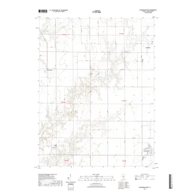
2018 Map of Stewardson West
USGS Topo · Published 2018About this map
Richland Creek and its many tributaries, including Brush Creek and Howe Creek, carve a distinct drainage pattern across this Shelby County landscape. Small rural communities are dispersed throughout the township divisions, with Stewardson situated at the southern edge and Strasburg to the northeast. These settlements serve as hubs for a network of country roads like Clarksburg Road and County Highway 32 that connect the isolated farmsteads typical of the Illinois prairie.
Find a feature on this map
38 named features on this map. Tap any name to fly to it.
Don’t see what you’re looking for? This feature index may not catch every label — zoom into the map to look around manually.
Map Details
Editions of this 2018 Stewardson West Map
This is the sole edition of this map. No revisions or reprints were ever made.
Other maps of this area

1941 · St. Elmo
USGS Topo · 1:62,500

1942 · Shelbyville
USGS Topo · 1:62,500

1945 · St. Elmo
USGS Topo · 1:62,500

1946 · Shelbyville
USGS Topo · 1:62,500

1947 · Stewardson
USGS Topo · 1:62,500

1949 · Stewardson
USGS Topo · 1:62,500

1950 · Effingham
USGS Topo · 1:62,500

1951 · Effingham
USGS Topo · 1:62,500

1958 · Decatur
USGS Topo · 1:250,000

1961 · Decatur
USGS Topo · 1:250,000