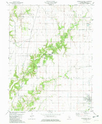
1981 Map of Stewardson West
USGS Topo · Published 1982About this map
The agrarian and forested landscapes of Shelby County are defined by the convergence of several townships, including Shelbyville, Richland, Clarksburg, Prairie, and Holland. At this time in the early 1980s, the village of Stewardson serves as a local hub near the intersection of the Norfolk and Western and an old railroad grade. To the west, the village of Mode and the settlement of Clarksburg anchor the rural landscape. Much of the central terrain is dedicated to conservation, with the Hidden Springs State Forest and Richland State Forest preserving the wooded corridors along Richland Creek. Local history is preserved in several small burial grounds and rural houses of worship, such as Grace Cem, St Pauls Cem, and Washington Ch. The presence of an oil field and a Quarry near the Brush Creek drainage points to the region's diverse rural economy beyond traditional farming.
Find a feature on this map
38 named features on this map. Tap any name to fly to it.
Don’t see what you’re looking for? This feature index may not catch every label — zoom into the map to look around manually.
Map Details
Editions of this 1981 Stewardson West Map
This is the sole edition of this map. No revisions or reprints were ever made.
Other maps of this area

1941 · St. Elmo
USGS Topo · 1:62,500

1942 · Shelbyville
USGS Topo · 1:62,500

1945 · St. Elmo
USGS Topo · 1:62,500

1946 · Shelbyville
USGS Topo · 1:62,500

1947 · Stewardson
USGS Topo · 1:62,500

1949 · Stewardson
USGS Topo · 1:62,500

1950 · Effingham
USGS Topo · 1:62,500

1951 · Effingham
USGS Topo · 1:62,500

1958 · Decatur
USGS Topo · 1:250,000

1961 · Decatur
USGS Topo · 1:250,000