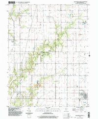
1998 Map of Stewardson West
USGS Topo · Published 2003About this map
The central drainage of Richland Creek defines this area of Shelby County, where dense woodlands of the Hidden Springs State Forest contrast with the surrounding prairie townships of Clarksburg and Prairie. The landscape is a mix of small agricultural hubs like Stewardson and Mode, and a network of rural burial grounds such as St Pauls Cem and Rockford Cem. The forest area itself is well-developed for recreation, featuring the Possum Creek Campground and Rolling Meadows Use Area. Industrial traces appear in the southern sections, marked by an Oil Field and a Quarry near the creek bends. Historical transport remains visible through the Old Railroad Grade running north of Herborn, while local governance is anchored by the Townhall in Clarksburg, serving a community rooted in the land between Brush Creek and Howe Creek.
Find a feature on this map
37 named features on this map. Tap any name to fly to it.
Don’t see what you’re looking for? This feature index may not catch every label — zoom into the map to look around manually.
Map Details
Editions of this 1998 Stewardson West Map
This is the sole edition of this map. No revisions or reprints were ever made.
Other maps of this area

1941 · St. Elmo
USGS Topo · 1:62,500

1942 · Shelbyville
USGS Topo · 1:62,500

1945 · St. Elmo
USGS Topo · 1:62,500

1946 · Shelbyville
USGS Topo · 1:62,500

1947 · Stewardson
USGS Topo · 1:62,500

1949 · Stewardson
USGS Topo · 1:62,500

1950 · Effingham
USGS Topo · 1:62,500

1951 · Effingham
USGS Topo · 1:62,500

1958 · Decatur
USGS Topo · 1:250,000

1961 · Decatur
USGS Topo · 1:250,000