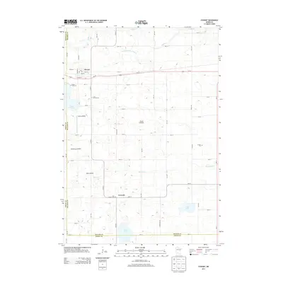
2013 Map of Stewart
USGS Topo · Published 2013About this map
Stewart serves as the primary hub in this corner of Mcleod Co, situated along the Us-212 corridor and the boundary with Renville Co. The landscape is a complex network of agricultural drainage and natural hydrology, defined by features like Buffalo Cr to the north and High Island Cr to the south. A notable characteristic of the local geography is the presence of several large drained basins, including Nutter Lakebed, Halls Lakebed, and Showburg Lakebed, illustrating the intensive land modification common in this region of Minnesota.
Find a feature on this map
54 named features on this map. Tap any name to fly to it.
Don’t see what you’re looking for? This feature index may not catch every label — zoom into the map to look around manually.
Map Details
Editions of this 2013 Stewart Map
This is the sole edition of this map. No revisions or reprints were ever made.
Other maps of this area

1953 · New Ulm
USGS Topo · 1:250,000

1957 · New Ulm
USGS Topo · 1:250,000

1958 · New Ulm
USGS Topo · 1:250,000

1958 · Winthrop
USGS Topo · 1:62,500

1958 · Hutchinson
USGS Topo · 1:62,500

1964 · Buffalo Lake
USGS Topo · 1:24,000

1964 · Gibbon
USGS Topo · 1:24,000

1967 · New Ulm
USGS Topo · 1:250,000
1967 · Lake Allie
USGS Topo · 1:24,000
1982 · Heatwole
USGS Topo · 1:24,000