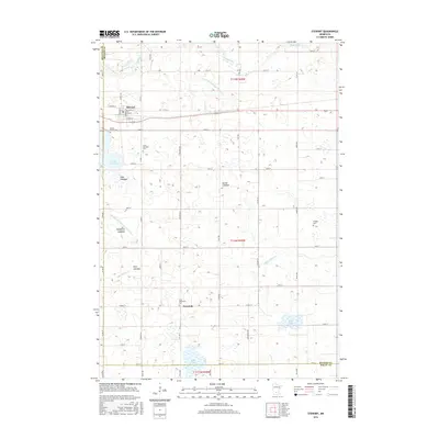
2016 Map of Stewart
USGS Topo · Published 2016About this map
Stewart serves as a primary hub of settlement in this part of McLeod County, characterized by a structured grid of streets such as Main St and Croyden St. To the south, the village of Fernando marks a smaller node of activity near the McLeod Co Sibley Co line. The landscape is defined by its complex drainage and reclamation history, with numerous drained basins or shallow waters identified as lakebeds, including Halls Lakebed, Nutter Lakebed, and Showburg Lakebed.
Find a feature on this map
64 named features on this map. Tap any name to fly to it.
Don’t see what you’re looking for? This feature index may not catch every label — zoom into the map to look around manually.
Map Details
Editions of this 2016 Stewart Map
This is the sole edition of this map. No revisions or reprints were ever made.
Other maps of this area

1953 · New Ulm
USGS Topo · 1:250,000

1957 · New Ulm
USGS Topo · 1:250,000

1958 · New Ulm
USGS Topo · 1:250,000

1958 · Winthrop
USGS Topo · 1:62,500

1958 · Hutchinson
USGS Topo · 1:62,500

1964 · Buffalo Lake
USGS Topo · 1:24,000

1964 · Gibbon
USGS Topo · 1:24,000

1967 · New Ulm
USGS Topo · 1:250,000
1967 · Lake Allie
USGS Topo · 1:24,000
1982 · Heatwole
USGS Topo · 1:24,000