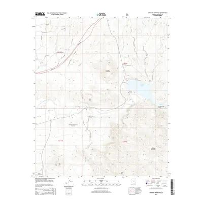
2014 Map of Stewart Mountain
USGS Topo · Published 2014About this map
The Salt River carves a deep path through this portion of the Tonto National Forest, feeding the expansive Saguaro Lake behind the dam at Stewart Mountain. The landscape is defined by its dramatic geologic features, from the jagged Goldfield Mountains in the southeast to the isolated peaks of Lone Mtn and One Mtn. This modern survey illustrates the intersection of wild desert terrain and residential development near the Goldfield Ranch Airport. Navigation through this arid environment is facilitated by a network of specialized roads and trails such as Beeline Hwy, E Thirsty Earth Trl, and N Burnt Water Trl. Notable landmarks like the Sheep Bridge and Sunrise Arch offer specific points of interest for researchers tracking historical access points and natural monuments within the canyon systems of Bulldog Canyon and Jones Canyon.
Find a feature on this map
36 named features on this map. Tap any name to fly to it.
Don’t see what you’re looking for? This feature index may not catch every label — zoom into the map to look around manually.
Map Details
Editions of this 2014 Stewart Mountain Map
This is the sole edition of this map. No revisions or reprints were ever made.
Other maps of this area

1900 · Florence
USGS Topo · 1:125,000

1902 · Florence
USGS Topo · 1:125,000

1904 · Desert Well
USGS Topo · 1:62,500

1904 · Ft. McDowell
USGS Topo · 1:62,500

1906 · Ft. McDowell
USGS Topo · 1:62,500

1906 · Desert Well
USGS Topo · 1:62,500

1907 · Roosevelt
USGS Topo · 1:125,000

1909 · Four Peaks
USGS Topo · 1:125,000

1912 · Roosevelt
USGS Topo · 1:125,000

1930 · Cave Creek
USGS Topo · 1:125,000