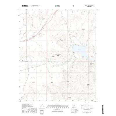
2018 Map of Stewart Mountain
USGS Topo · Published 2018About this map
Sheep Bridge serves as a key crossing point where the Salt River winds through the protected landscape of the Tonto National Forest. This 2018 survey reveals the topographical complexity of the Sonoran Desert, dominated by the Stewart Mtn massif and the Goldfield Mountains. The presence of Saguaro Lake at the northeastern corner of the map highlights the managed hydrology of the region, providing a contrast to the seasonal drainages found in Bulldog Canyon and Whiteface Canyon. Modern infrastructure is visible through a network of trails and roads such as N Boot Hill Pkwy and N Old Bush Hwy, which provide access to geological landmarks like Sunrise Arch and the prominent Blue Point. The map provides a detailed view of the high-relief terrain surrounding Dome Mtn and Lone Mtn, documenting the area before significant modern shifts in access or recreation management.
Find a feature on this map
33 named features on this map. Tap any name to fly to it.
Don’t see what you’re looking for? This feature index may not catch every label — zoom into the map to look around manually.
Map Details
Editions of this 2018 Stewart Mountain Map
This is the sole edition of this map. No revisions or reprints were ever made.
Other maps of this area

1900 · Florence
USGS Topo · 1:125,000

1902 · Florence
USGS Topo · 1:125,000

1904 · Desert Well
USGS Topo · 1:62,500

1904 · Ft. McDowell
USGS Topo · 1:62,500

1906 · Ft. McDowell
USGS Topo · 1:62,500

1906 · Desert Well
USGS Topo · 1:62,500

1907 · Roosevelt
USGS Topo · 1:125,000

1909 · Four Peaks
USGS Topo · 1:125,000

1912 · Roosevelt
USGS Topo · 1:125,000

1930 · Cave Creek
USGS Topo · 1:125,000