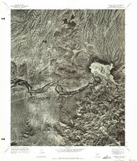
1971 Map of Stewart Mtn.
USGS Topo · Published 1972About this map
Saguaro Lake and the Salt River dominate this 1971 orthophotoquad, which uses aerial photography to capture the arid landscape of Maricopa County. The imagery provides a clear view of the winding river corridor as it cuts through the desert terrain, bounded by distinctive elevations such as Stewart Mtn to the north and Lone Mtn in the south. Because this is a photogrammetric mosaic rather than a traditional line-drawn topographic map, the view preserves the actual vegetation patterns and geological textures of the Salt River Valley during the early 1970s. This specialized format highlights the stark contrast between the reservoir waters and the surrounding desert peaks, offering a raw photographic record of the region before significant modern development altered the shoreline and nearby lands.
Find a feature on this map
4 named features on this map. Tap any name to fly to it.
Don’t see what you’re looking for? This feature index may not catch every label — zoom into the map to look around manually.
Map Details
Editions of this 1971 Stewart Mtn. Map
This is the sole edition of this map. No revisions or reprints were ever made.
Other maps of this area

1900 · Florence
USGS Topo · 1:125,000

1902 · Florence
USGS Topo · 1:125,000

1904 · Desert Well
USGS Topo · 1:62,500

1904 · Ft. McDowell
USGS Topo · 1:62,500

1906 · Ft. McDowell
USGS Topo · 1:62,500

1906 · Desert Well
USGS Topo · 1:62,500

1907 · Roosevelt
USGS Topo · 1:125,000

1909 · Four Peaks
USGS Topo · 1:125,000

1912 · Roosevelt
USGS Topo · 1:125,000

1930 · Cave Creek
USGS Topo · 1:125,000