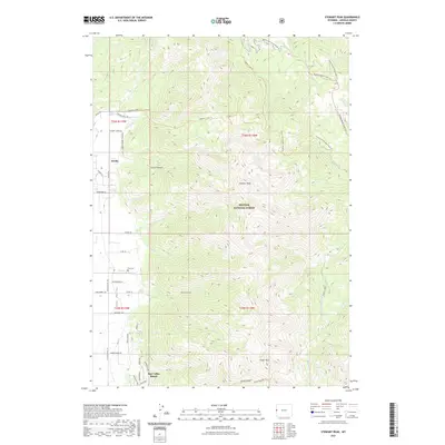
2021 Map of Stewart Peak
USGS Topo · Published 2021About this map
Star Valley Ranch serves as a primary residential focal point in this high-altitude landscape, situated along the western edge of the Bridger National Forest. The transition from the residential grid of Star Valley into the steep, rising slopes of the Salt River Range is clearly marked by the dense network of canyons and peaks. Dominant landmarks such as Stewart Peak and Prater Mtn overlook a complex system of drainage creeks and seasonal trails, including Wolfley Canyon and Prater Canyon. Genealogists and local historians can locate the Etna Cem near the settlement of Nordic, while recreational researchers can trace the extensive trail system that includes the Squaw Creek Trl and Murphy-Squaw Creek Trl. The map reflects a modern era of forest management and rural residential development where the wildness of Corral Canyon meets the established roads of Lincoln County.
Find a feature on this map
53 named features on this map. Tap any name to fly to it.
Don’t see what you’re looking for? This feature index may not catch every label — zoom into the map to look around manually.
Map Details
Editions of this 2021 Stewart Peak Map
This is the sole edition of this map. No revisions or reprints were ever made.
Other maps of this area

1915 · Freedom
USGS Topo · 1:62,500

1921 · Afton
USGS Topo · 1:125,000

1931 · Jackson
USGS Topo · 1:125,000

1932 · Irwin
USGS Topo · 1:96,000

1935 · Irwin
USGS Topo · 1:125,000

1935 · Jackson
USGS Topo · 1:125,000

1955 · Driggs
USGS Topo · 1:250,000

1955 · Preston
USGS Topo · 1:250,000

1958 · Driggs
USGS Topo · 1:250,000

1958 · Preston
USGS Topo · 1:250,000