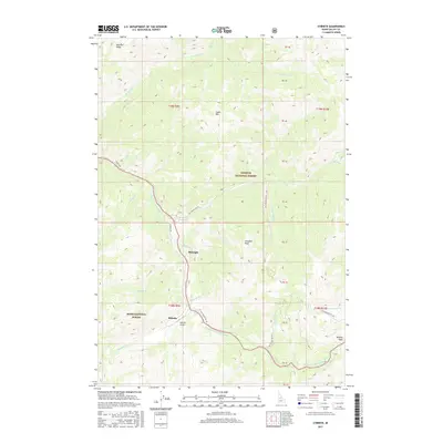
2017 Map of Stibnite
USGS Topo · Published 2017About this map
Stibnite and the nearby settlement of Midnight are the primary focal points of this 2017 survey, set deep in the mountainous divide between the Payette National Forest and Boise National Forest. The landscape is defined by the winding course of the E Fork S Fork Salmon River, which is paralleled by Stibnite Rd as it provides access to this isolated area. The presence of the Stibnite Airport underscores the logistical challenges of the terrain, where elevations rise sharply to landmarks like Cinnabar Peak and Sugar Mtn. Numerous drainages, including Garnet Cr and Fiddle Cr, carve through the high country, while the eastern edge is marked by the rugged Thunder Mtn Rd and the prominent Murphy Peak. The map provides a clear view of the complex land partitions and forest boundaries that govern this high-elevation wilderness.
Find a feature on this map
41 named features on this map. Tap any name to fly to it.
Don’t see what you’re looking for? This feature index may not catch every label — zoom into the map to look around manually.
Map Details
Editions of this 2017 Stibnite Map
This is the sole edition of this map. No revisions or reprints were ever made.
Other maps of this area

1937 · Yellow Pine
USGS Topo · 1:48,000

1937 · Big Creek
USGS Topo · 1:48,000

1942 · Big Creek
USGS Topo · 1:62,500

1943 · Yellow Pine
USGS Topo · 1:62,500

1956 · Elk City
USGS Topo · 1:250,000

1957 · Challis
USGS Topo · 1:250,000

1960 · Elk City
USGS Topo · 1:250,000

1960 · Challis
USGS Topo · 1:250,000

1963 · Challis
USGS Topo · 1:250,000

1969 · Edwardsburg
USGS Topo · 1:24,000