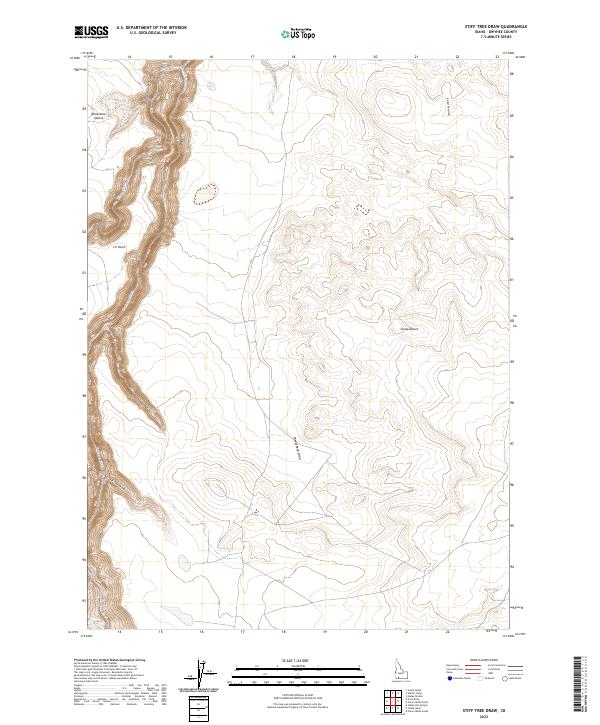
2023 Map of Stiff Tree Draw
USGS Topo · Published 2023About this map
Bruneau Canyon dominates this high-desert landscape in Owyhee County, where the Bruneau Wild and Scenic River carves a deep, serpentine path through the volcanic plateau. This remote corner of Idaho is largely defined by the Bruneau-Jarbidge Rivers Wilderness, preserving an environment where natural drainage patterns like Stiff Tree Draw and Sheepshead Draw converge toward the primary river corridor.
Find a feature on this map
14 named features on this map. Tap any name to fly to it.
Don’t see what you’re looking for? This feature index may not catch every label — zoom into the map to look around manually.
Map Details
Editions of this 2023 Stiff Tree Draw Map
This is the sole edition of this map. No revisions or reprints were ever made.
Other maps of this area

1955 · Twin Falls
USGS Topo · 1:250,000

1956 · Blue Butte
USGS Topo · 1:62,500

1956 · Winter Camp
USGS Topo · 1:62,500

1958 · Twin Falls
USGS Topo · 1:250,000

1979 · Stiff Tree Draw
USGS Topo · 1:24,000

1979 · Indian Hot Springs
USGS Topo · 1:24,000

1979 · Clover Butte South
USGS Topo · 1:24,000

1979 · Cave Draw
USGS Topo · 1:24,000
1979 · Inside Lakes
USGS Topo · 1:24,000
1980 · Austin Butte
USGS Topo · 1:24,000