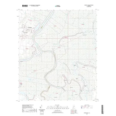
2020 Map of Stiggins Lake
USGS Topo · Published 2020About this map
Mount Vernon and the site of Fort Stoddard anchor this landscape where the Mobile River and Tensaw River dominate the low-lying terrain. The map captures a complex delta environment defined by shifting watercourses like Minnow Slough and Lake Slough, alongside numerous named islands such as Canal Island and Robinson Island. The road network around Mount Vernon follows established paths, including the Old Military Rd and Shepard Lake Rd S.
Find a feature on this map
56 named features on this map. Tap any name to fly to it.
Don’t see what you’re looking for? This feature index may not catch every label — zoom into the map to look around manually.
Map Details
Editions of this 2020 Stiggins Lake Map
This is the sole edition of this map. No revisions or reprints were ever made.
Other maps of this area

1941 · Bay Minette
USGS Topo · 1:62,500

1941 · Creola
USGS Topo · 1:62,500

1943 · Creola
USGS Topo · 1:62,500

1943 · Bay Minette
USGS Topo · 1:62,500

1943 · Tensaw
USGS Topo · 1:62,500

1943 · Citronelle
USGS Topo · 1:62,500

1944 · Tensaw
USGS Topo · 1:62,500

1946 · Citronelle
USGS Topo · 1:62,500

1953 · Andalusia
USGS Topo · 1:250,000

1953 · Hattiesburg
USGS Topo · 1:250,000