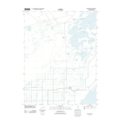
2011 Map of Stillwater
USGS Topo · Published 2011About this map
Stillwater and its surrounding wetlands dominate this landscape in the early twenty-first century, revealing an intricate network of desert water management and agricultural settlement. The region is defined by the Stillwater Slough and a vast complex of lakes and ponds, including Dutch Bill Lake, Lead Lake, and Stillwater Point Reservoir. These water bodies are interspersed with land features such as Welch Island and Lund Island, reflecting the area's importance as a terminal drainage basin.
Find a feature on this map
48 named features on this map. Tap any name to fly to it.
Don’t see what you’re looking for? This feature index may not catch every label — zoom into the map to look around manually.
Map Details
Editions of this 2011 Stillwater Map
This is the sole edition of this map. No revisions or reprints were ever made.
Other maps of this area

1908 · Carson Sink
USGS Topo · 1:250,000

1910 · Carson Sink
USGS Topo · 1:250,000

1950 · Stillwater
USGS Topo · 1:62,500

1951 · Carson Lake
USGS Topo · 1:62,500

1957 · Reno
USGS Topo · 1:250,000

1959 · Reno
USGS Topo · 1:250,000

1960 · Reno
USGS Topo · 1:250,000

1969 · Pintail Bay
USGS Topo · 1:24,000

1969 · Foxtail Lake
USGS Topo · 1:24,000

1972 · Diamond Canyon
USGS Topo · 1:24,000