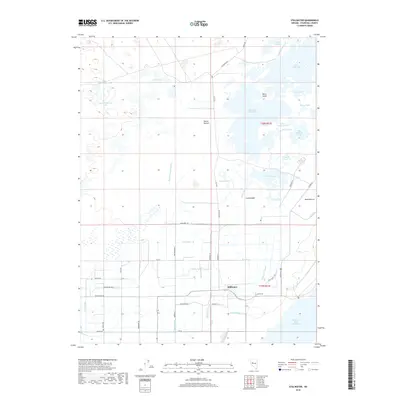
2018 Map of Stillwater
USGS Topo · Published 2018About this map
Stillwater and its surrounding wetlands dominate this desert landscape, where a complex network of man-made waterways manages the flow through an arid basin. The map illustrates a highly engineered environment of canals and drains, such as the Lead-Bypass Canal and Stillwater Slough, which feed into numerous named water bodies including North Lead Lake and Stillwater Point Reservoir. These features reflect the long-standing efforts to reclaim and manage water for both agricultural and wildlife purposes in this part of Nevada.
Find a feature on this map
60 named features on this map. Tap any name to fly to it.
Don’t see what you’re looking for? This feature index may not catch every label — zoom into the map to look around manually.
Map Details
Editions of this 2018 Stillwater Map
This is the sole edition of this map. No revisions or reprints were ever made.
Other maps of this area

1908 · Carson Sink
USGS Topo · 1:250,000

1910 · Carson Sink
USGS Topo · 1:250,000

1950 · Stillwater
USGS Topo · 1:62,500

1951 · Carson Lake
USGS Topo · 1:62,500

1957 · Reno
USGS Topo · 1:250,000

1959 · Reno
USGS Topo · 1:250,000

1960 · Reno
USGS Topo · 1:250,000

1969 · Pintail Bay
USGS Topo · 1:24,000

1969 · Foxtail Lake
USGS Topo · 1:24,000

1972 · Diamond Canyon
USGS Topo · 1:24,000